Hartwell Lake at Flood Stage Says National Weather Service
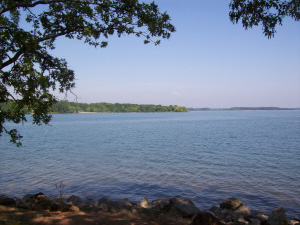
Photo by MJ Kneiser
Hartwell Lake is nearing historic levels and now the National Weather Service in Greenville-Spartanburg says the lake has reached flood stage.
As of Monday, the level stood at just over 664 feet above mean sea level.
But Meteorologist Justin Lane said flood stage for the National Weather Service is considered 665 ft msl, which he said happened overnight.
“Actually a couple of our gauges on the lake are already exceeding what we have established as flood stage,” Lane said. “We are in uncharted territory here because we’re approaching record levels for the lake. So we’re not absolutely, 100% sure what kind of impact this is going to have,” Lane said.
Lane said the National Weather Service has two gauges on the lake to measure lake levels and he said both gauges, one on the Georgia side at Hartwell Dam, the other on the South Carolina side in Anderson have indicated the lake is at flood stage.
However, Lane said at the 665 msl level, problems with streams and rivers overflowing their banks occurs.
“The reason we established that (level) as flood stage is because a lot of our lakes and streams start to overflow their banks and some of the docks will start to get submerged on the lake side.”
What does this mean for communities surrounding the lake? Lane said for there to be any major impact on Hartwell and surrounding areas, the lake level would have to rise much higher.
“I think major flooding is considered about 680 msl and the lake has never been anywhere close to that level,” Lane said. “So that’s purely theoretical as to when we think major flooding would occur and we’re not getting anywhere close to that.”
Lane said however, the National Weather Service has never before designated the lake as reaching flood stage.
Stay with us for the latest from the National Weather Service and the U.S. Army Corps of Engineers on the lake levels and all your weather for Northeast Georgia.